Hello,
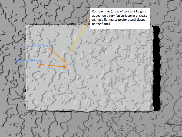
I have a question regarding the output depth images from the Astra. There appears to be a wavy sand-like pattern in the output images (see example image below). The depth values also vary across these contours by an approximate step of ~11mm. For example. all the points in one contour will have a fixed height and will increase/decrease by a factor of ~11mm across the next contour. Please refer tho the sample image below:

It appears that the depth values are binned. Meaning all the values lying in a certain depth range are assigned a constant value.
It would be much appreciated if this behavior could be explained.
Thank you!
